Available for iOS and Android
APP + WEBSITE FEATURES
GPS Tracks and Waypoints
The GPS and Waypoints features of Disaster Surveyor have been designed with years of real world search and rescue experience to focus on the key core features that have been found useful over time. In addition to the main GPS
Area Maps
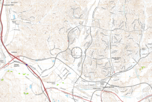
The Area Maps section of the app contains a variety of useful tools for both online and offline maps. Options for maps include loading pdf maps via URL, via Dropbox, via QR/Barcode scanning of a pdf map URL, or generating a live
Worksite Report Forms
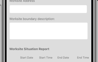
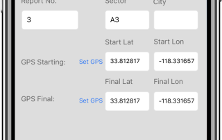
The Worksite Report forms are the overall worksite situation report for rescue counts, deceased victims recovered, current status of operations, and information related to the particular worksite operation such as ongoing worksite planing information, local activities, resources released, any local emergency contact
Sector Assessment Forms
The Sector Assessment forms help create an overall picture of the entire sector including all its worksites and victim forms during search and rescue operations. The forms comply with United Nations INSARAG sector assessment forms. The home screen for your sector assessment
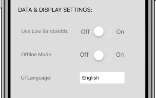
Options and Settings
Disaster Surveyor has several options and settings that are cognizant of the type of unexpected emergency environments and countries an International USAR team, or even a domestic team when all power is out may encounter. The settings screen allows the user to set GPS
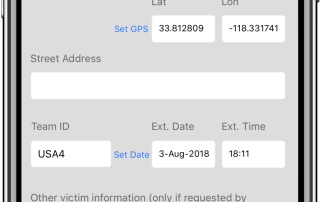
Victim Extrication Forms
The Victim Extrication forms gather information about victims found in a disaster worksite. The forms comply with United Nations INSARAG victim extrication forms. The home screen for your victim forms displays a checkbox to indicate which forms to upload when the
Other Features
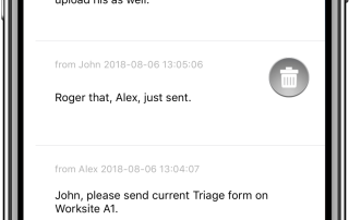
Disaster Surveyor includes a simple text-based team chat. Every photo saved directly to a form can also be detached and reassigned to a different form using the master photo gallery. The side menu also includes a INSARAG field guideline as pertains to
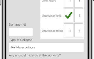
Worksite Triage Forms
The Worksite Triage forms help gather preliminary data during initial review of a disaster worksite. The forms comply with United Nations INSARAG worksite triage forms. The home screen for your worksite forms displays a checkbox to indicate which forms to upload
FEMA Waypoints and Tracking sets
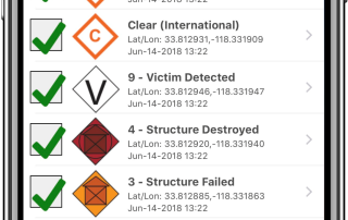
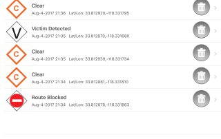
Disaster Surveyor has incorporated the most comprehensive set of GPS marker icons as utilized by both the United Nations INSARAG teams and the U.S. FEMA GPS marker sets. As a search and rescue worker begins his route, an automated Tracker can be set with increments of
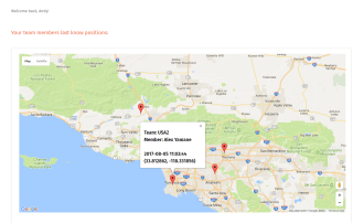
Team collaboration
Disaster Survey has been designed to work with multiple team groups with a central management tool for any adhoc emergency Base of Operations or coordination cell. Each team member assigned to a particular team ID are grouped together and an operation commander may again instant situational
Create your account by downloading the app from the app store or creating your login below. The account you create is used to login to both the app and the website. For Commander Edition version of the website features, please contact us at andy@disastersurveyor.com to have your account upgraded. All users who sign up using the same Team ID are grouped together for the Commander Edition.