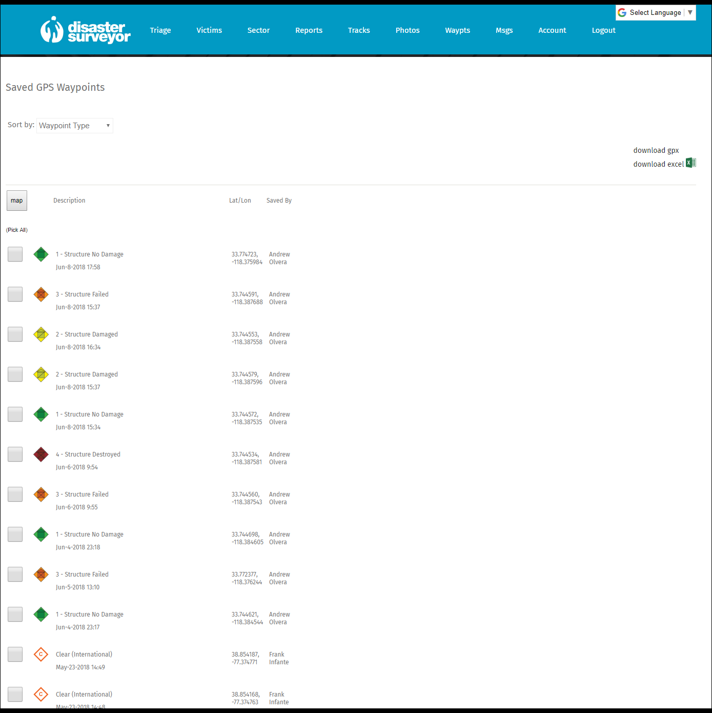
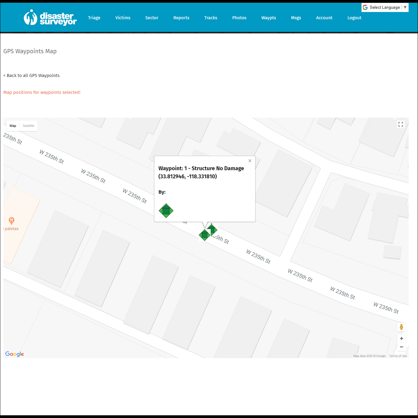
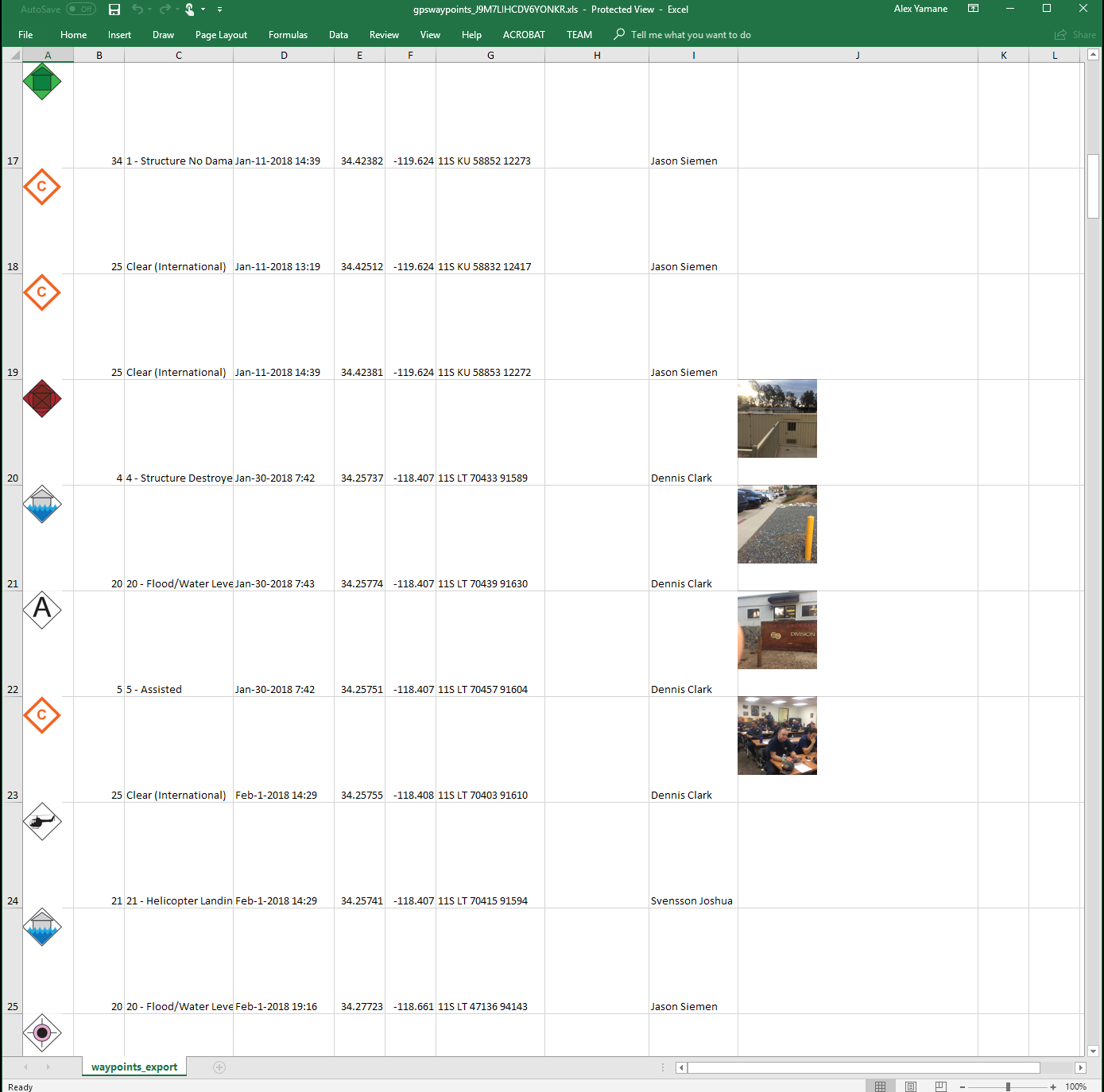
The commander edition website displays all team member uploaded waypoints saved uploaded via sector form, at a glance in a list, and can be displayed on a map for better situational awareness, geographically. The popup windows contain the lat/long of the track point, any photos saved to the waypoint, the icon to indicate what type of waypoint it is, along with who the track was reported by. Waypoints can be sorted by type, date, sector forms they belong to, and who reported them. Because Disaster Surveyor is built with the boots on the ground first, commanders can edit and/or delete waypoints on the website, and ask a rescue worker to re-upload their waypoints (associated to a Sector form) without affecting the copy on the mobile device for that user. The waypoints can also be downloaded as an Excel or GPX file for use in Arcview GIS or any 3rd party mapping solutions that can import this format. Only waypoints for users selected for display in the operation (in the “Account” settings) are displayed for management.