You are here:Home-Uncategorized

Team Messaging

To view team messages, tap the “Messages” button on the bottom left of the app Home screen (figure 43). If a new team message exists, the icon will turn red to indicate a new unread message exists. Opening the team messages screen will remove the red indicator. To send a new team message, enter your

By |2022-07-14T02:20:29-07:00July 14th, 2022|Categories: Uncategorized|Comments Off on Team Messaging

App Settings

To open the Settings screen, from the app home screen, tap “menu” in the upper right, then choose “Settings”. You will be displayed the Settings screen (figure 47). The “Logged in as:” displays which email address account is currently logged into the app. “Use Low Bandwidth” setting: When set to “On”, the app will only

By |2022-07-14T02:20:29-07:00July 14th, 2022|Categories: Uncategorized|Comments Off on App Settings

Photos and Cameras

To view all photos in the app, tap “Photos” on the right side of the app home screen (figure 48). To take an unassigned photo, tap “Camera” on the right side of the home screen. This will add a photo to the app that is not yet assigned to any form or waypoint. To have

By |2022-07-14T02:20:29-07:00July 14th, 2022|Categories: Uncategorized|Comments Off on Photos and Cameras

Signing Up

To create an account, enter first name, last name, email, password, and optional Team Code (up to 6 alphanumeric characters). All users who wish to coordinate as part of the same team (and be visible to their account Team Admin or Ops Coordinator) must use the same team code. To approve a new team member,

By |2022-07-14T02:20:29-07:00July 14th, 2022|Categories: Uncategorized|Comments Off on Signing Up

FEMA Waypoints and Tracking sets

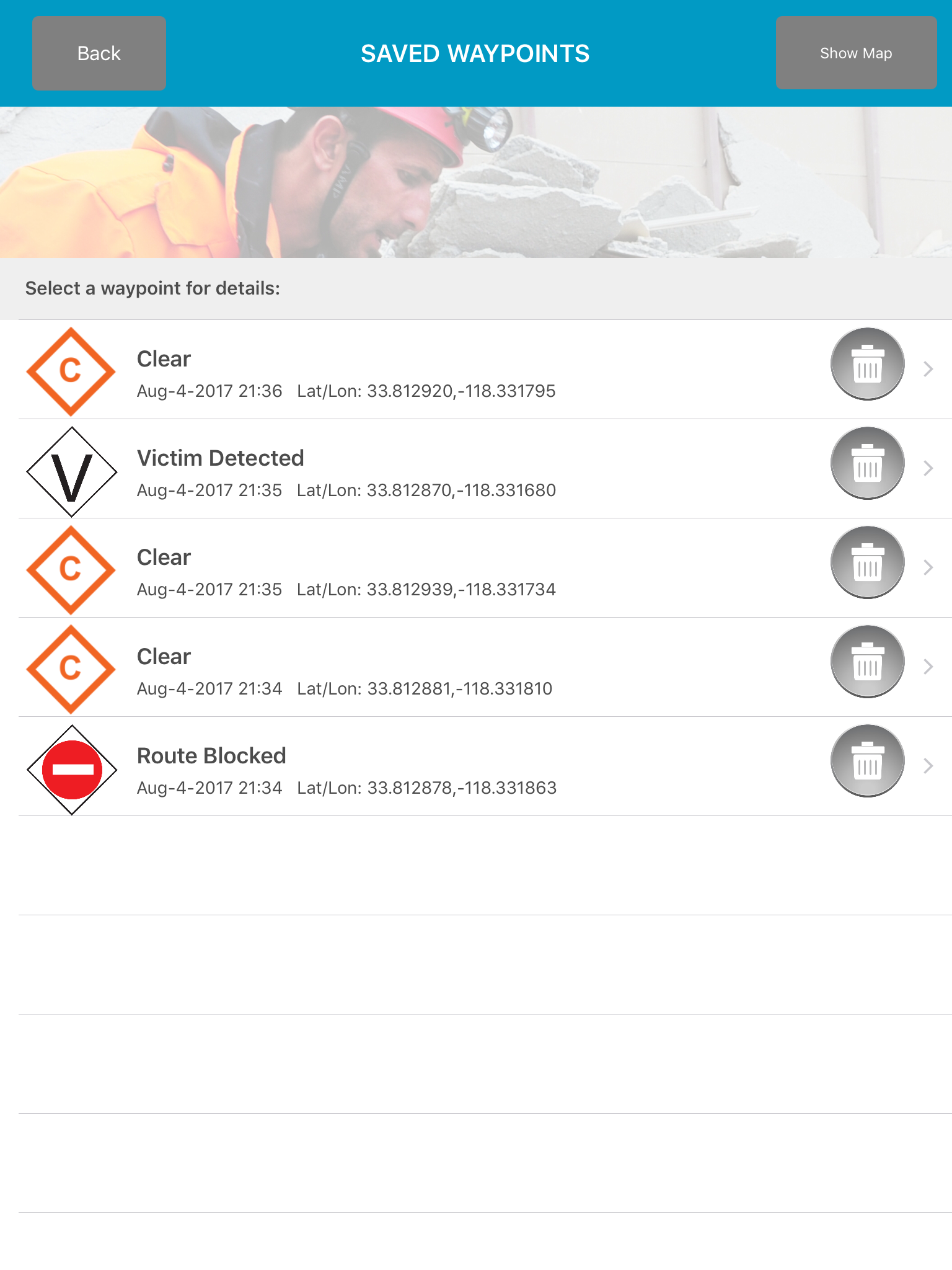
Disaster Surveyor has incorporated the most comprehensive set of GPS marker icons as utilized by both the United Nations INSARAG teams and the U.S. FEMA GPS marker sets. As a search and rescue worker begins his route, an automated Tracker can be set with increments of 1, 5, 10, 15, 30,

By |2017-08-05T10:59:02-07:00August 5th, 2017|Categories: Android, Apple, Apps, Featured, News, Uncategorized|Comments Off on FEMA Waypoints and Tracking sets

Offline Maps and Photos

Disaster Surveyor allows saved reference pdf maps to be used in conjunction with data collection efforts while making initial worksite assessments. For emergencies when referenced maps are not yet available, a Google Maps feature allows for finding a general map of the area, to be saved as a pdf to be used offline in the

By |2016-08-30T22:31:45-07:00August 30th, 2016|Categories: Apps, Featured, Gadgets, Hardware, News, Photography, Reviews, Tutorials, Uncategorized|Comments Off on Offline Maps and Photos

Offline Maps and Photos

Disaster Surveyor allows saved reference pdf maps to be used in conjunction with data collection efforts while making initial worksite assessments. For emergencies when referenced maps are not yet available, a Google Maps feature allows for finding a general map of the area, to be saved as a pdf to be used offline in the

By |2016-08-30T22:30:53-07:00August 30th, 2016|Categories: Apps, Featured, Gadgets, Hardware, News, Reviews, Tutorials, Uncategorized|Comments Off on Offline Maps and Photos
Go to Top