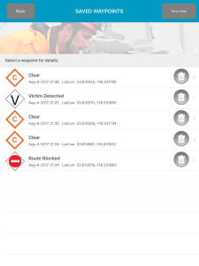
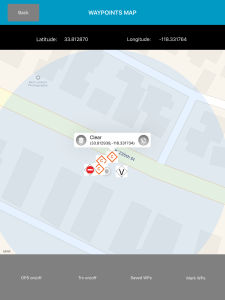
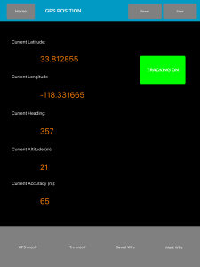
Disaster Surveyor has incorporated the most comprehensive set of GPS marker icons as utilized by both the United Nations INSARAG teams and the U.S. FEMA GPS marker sets. As a search and rescue worker begins his route, an automated Tracker can be set with increments of 1, 5, 10, 15, 30, 60, 120, and 300 second intervals. These GPS lat/lon points can be displayed on a map within the app, and track points may be deleted or edited prior to uploading to the central website system to the team commander. Additionally, GPS waypoint markers can be dropped at any location, and also shown on a map, with icons for those incident indicators displayed on the map and editable as well.