- To view GPS Waypoints uploaded by the team, click on the “Waypts” link in the top menu (figure 75). GPS Waypoints are displayed for team members selected for display in the “Account” section of the website. A list of which team members’ data is shown is displayed at the top of the page.
- To see a map of where the GPS Waypoints are located, check the checkboxes next to the desired GPS Waypoints on the left most column, then click the “map” button above it (figure 76).
- To delete multiple GPS Waypoints, check the checkboxes and click the “Del” button on the bottom of the list.
- To download a GPX file of the Waypoints, select the checkboxes for desired Waypoints and click the “Download GPX” link on the upper right of the page.
- To download a KML file of the Waypoints, select the checkboxes for desired Waypoints and click the “Download KML” link on the upper right of the page.
- To download an Excel file of the Waypoints, select the checkboxes for desired Waypoints and click the “Download Excel” link or Excel icon on the upper right of the page. The Excel file will include both the Waypoint icons as well as thumbnails of any photos saved for each Waypoint (figure 77). For Waypoints collected using the US Domestic version of the app, downloading the Excel file in the corresponding website at https://us.disastersurveyor.com will also include all of the extended “follow up form” fields.
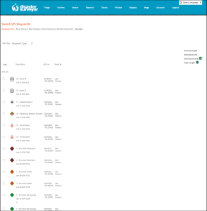 Figure 75. GPS Waypoints list |
|
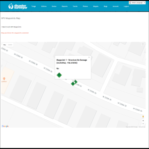 Figure 76. GPS Waypoints map |
|
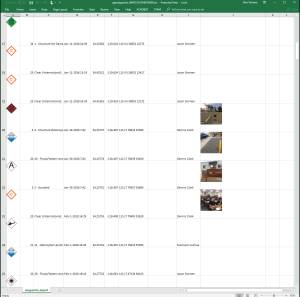 Figure 77. GPS Waypoints download |